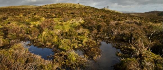
Many thousands of acres of moorland were drained by open ditches or ‘grips’ in the early 70’s, in line with the agricultural policy of the time, to grow more grass by drying out these areas of uplands. Serious erosion and loss of habitat has resulted, and blocking grips for the benefit of water quality, wildlife and landscape value now forms a major part of DMS work. Using aerial photography and GPS ground survey of the grip systems, new watersheds can be designed to take the water away from grips to be filled in, re-wet areas and take excess run-off water off the hill. These are designed to follow a route of minimal impact and erosion.
Grips, in some cases eroded to a 20 ft span and 24 ft deep, can be tackled using specialist equipment and techniques, whilst causing minimum impact to sensitive vegetation. Soil, surrounding turf and heather bales – sourced locally- are all used to best effect, keeping movement across the ground to a minimum. Packing grips with heather bales, creating dams, grading, re-turfing and ‘drip edge reprofiling’ can all be achieved leaving the site with little visual evidence that the work has been carried out.
Blanket Bog Restoration
One of the most environmentally and ecologically sensitive parts of the moor, blanket bog restoration often requires the water level to be raised to re-wet the surrounding area. Using well-keyed peat/clay dams topped off with vegetation from the grip sides is one tried and tested method. On the steeper slopes, peat dams with overflows to the bottom side can be constructed at close intervals to rewet the area below without causing any eroded overflow channels. Plastic piling dams can also be considered for these types of project.
GPS Survey
As a matter of project routine, DMS will undertake a GPS ground survey with our specialist low ground pressure vehicle. Our system ensures that all the grips in an area are accurately mapped and that each dam is planned. Not only does this assist in work planning, but also that the plan ensures that machine movement across the site is kept to an absolute minimum. The GPS work plan and map is loaded into the excavators’ GPS system so that the operator is never in any doubt about where he is and what needs to be done. Added advantages of this system are that all relevant hazards are pre located and loaded into the GPS system, and at the end of the project an accurate mapped record of the exact work completed can be presented to the client.


