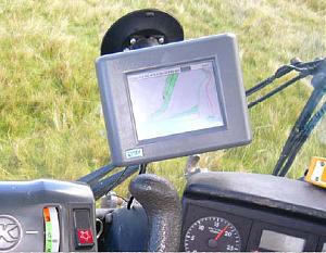
 Good planning of infrastructure and access before hand is an important factor in reducing risks and managing disasters, part of this planning can be clear knowledge of the site. DMS can produce plans by our own in house GPS data handling.
Site boundaries and access for your event can be mapped by our Geographic Information System, together with Ordnance Survey backing maps we can show any features on colour maps of any size.
For the health and safety of crowd control or replication of exact locations year on year, the geo-referenced data can be loaded onto any GPS equipment showing any specific data such as street closures and market stall locations.


